


Shell Rings to Submarines: A St. Simons Island Driving Tour

 About the Tour
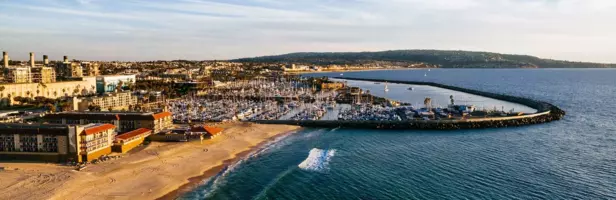
St. Simons Island is almost exactly the same size as Manhattan – but instead of skyscrapers, it has live oaks, and instead of eight million people, it has 6,000 years of layered history. On this driving tour, you'll trace the island's story from Indigenous shell rings to World War II submarine attacks, discovering how soldiers, enslaved communities, and seafood entrepreneurs shaped this Georgia barrier island.
The tour starts at the Pier Village parking lot at the end of Mallory Street, beside the old fishing docks where steam ferries once unloaded tourists in straw hats. From here, you'll drive past the St. Simons Lighthouse, built in 1872 on the footprint of an earlier light whose Confederate-hidden Fresnel lens has never been found, and along the coast where German U-boats torpedoed American oil tankers just offshore in 1942.
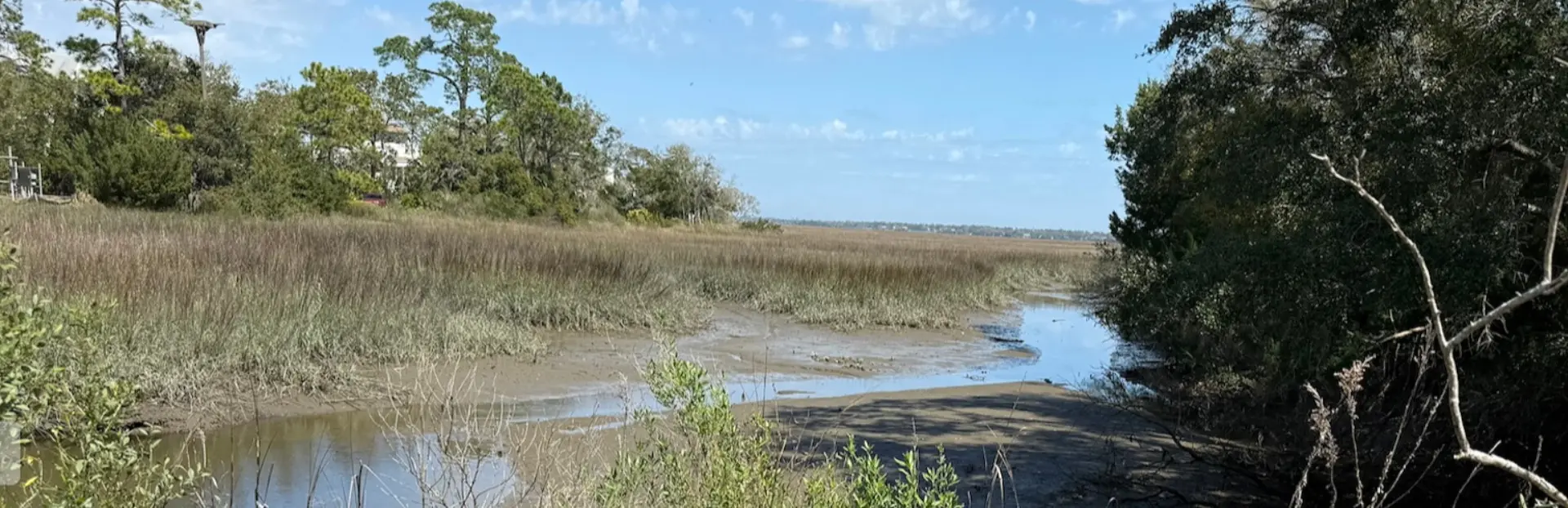
You'll continue north along Frederica Road, passing subdivisions that were once cotton plantations and a stretch of marsh that forms part of the largest continuous salt marsh system on the Atlantic coast. Along the way, you'll hear the story of Igbo Landing on Dunbar Creek, where a group of West Africans chose defiance over enslavement in 1803, and visit Fort Frederica National Monument, where General James Oglethorpe's outnumbered forces turned back a Spanish invasion fleet in 1742. The tour ends back at Neptune Park by the pier, named for Neptune Small, a man born into slavery on Retreat Plantation whose name now marks the land he eventually owned.
On this 90-minute tour, you'll have a chance to:
- Climb 129 steps to the top of the St. Simons Lighthouse for views stretching 22 miles out to sea
- Visit the WWII Home Front Museum in the former Coast Guard Station, built by the WPA in 1936
- Walk the marsh at Bloody Marsh, site of the 1742 ambush that kept Georgia under British control
- Explore First African Baptist Church, built in 1869 by formerly enslaved island residents
- Drive the oak-canopied avenue Anna Page King planted at Retreat Plantation
- Stop at the Historic Harrington School, the last one-room schoolhouse on the Georgia coast
Small in size but not in story, St. Simons rewards curious visitors. Paula's warm, personal narration makes 6,000 years of history feel like a conversation with a neighbor who has lived here for fifty of them.
Tour Producer

Paula Galland

St. Simons Island has been part of my life for nearly 50 years—and my favorite vacation destination since long before that. I spent my career here in the local schools as a history teacher and library media specialist, and my husband and I raised two sons on this island. So believe me, I know quite a few of the little secrets St. Simons kids tried their best to keep hidden.
These days, in retirement, I’m a docent at the World War II Home Front Museum, active in our island literary guild, and still deeply involved in the life of this community. I’ve always loved history, stories, and travel—and whenever I explore a new place, I’m usually doing it with a VoiceMap tour in my ears.
Over the years I’ve been honored as Apple Computer’s Georgia Educator of the Year, Georgia’s Media Specialist of the Year, and—most meaningful to me—Teacher of the Year at our local high school.
Now I’m delighted to return the favor by sharing the stories, history, and hidden corners of this beautiful island with you.
Save with audio tour passes
How do passes work?
Preview Location
Location 8
Park - Looking to the Ocean
We have a one of the largest in and out changes of tidal height on the coast, second only to northern Maine. Many a visitor has taken a walk on the beach only to return to f...
How VoiceMap Works


Major Landmarks
-
St. Simons Lighthouse
-
Neptune Park Fun Zone Pool
-
World War II Home Front Museum
-
Bloody Marsh
-
Fort Frederica National Monument
-
Christ Church Frederica
-
Retreat Golf Course
-
Pier Village Market
-
Massengale Park
Getting There
Route Overview
-
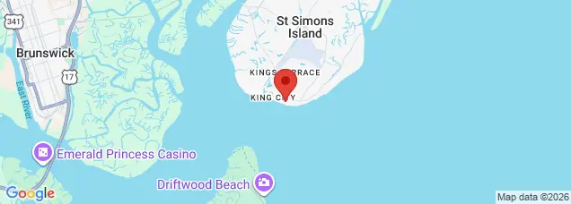
Start location200 Pier Aly, St Simons Island, GA 31522, USA
-
Total distance28km
-
Final location420 Kings Way, St Simons Island, GA 31522, USA
-
Distance back to start location394.86m
Directions to Starting Point
This tour begins in the St. Simons Island village area in the parking lot near the pier in front of Brogen's Restaurant. Park wherever you find a parking place. Since we will not be here long, you may even park in the loading zone if needed.
200 Pier Alley, St Simons Island, GA 31522
Tips
Places to stop along the way
You will have the opportunity to make lots of stops along the route. If you decide to spend a few hours at a museum, the beach, or a historical site, please do so. You can complete the tour later.
Best time of day
You might find a bit of traffic during busy tourist times, but that won't affect the VoiceMap. Any tiime during daylight hours will be great for this tour.
Precautions
Be careful not to run over pedestrians and bikers. Some of them might not understand the rules of the road.
Get The App