


 About the Tour
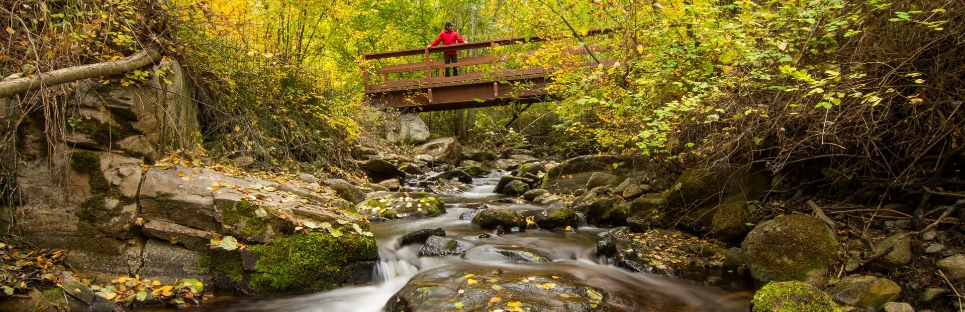
This linear hike to Naramata Creek Falls includes two creek crossings and a slippery scrabble around a breathtaking waterfall. On your way, learn about this desert region's relationship with water. Where does this crystalline stream flow from? How do we farm fruits and grapes in the desert? How did people reach this place before there were roads? What brought thousands of visitors to Naramata to scream in bleachers along the shoreline? Is there enough water today? As you ford the Naramata Creek and hike to the falls, we will share wet and wild tales of the snowy Monashee mountains, vintage paddle wheelers, snaking irrigation, and roaring regattas.
This tour begins in the Creek Park parking lot, just off Naramata Road, and ends near the falls. Along the way, you’ll have a chance to:
- Walk peacefully between the trees, along the picturesque Naramata Creek
- Splash through the creek like a bear, or clamber along the hillside like a goat to the base of the falls
- Gaze on the spectacular Naramata Falls
- Learn traditional knowledge from the Penticton Indian Band, on the red signs beside the path
- Experience some of the region's exciting nautical, cultural, and agricultural history
This hike takes place on the traditional, ancestral, and unceded territory of the syilx (Okanagan) people, who have resided here since time immemorial. We recognize, honour, and respect the syilx lands, and appreciate the opportunity to be in this special place.
This tour was narrated by Craig Henderson, written by Arnica Rowan, and produced by Terroir Consulting for Discover Naramata. Thanks to Destination BC, Wine Growers BC, the Naramata Bench Wineries Association, the Naramata Heritage Museum, and photographers Jon Adrian and Caillum Smith for the beautiful photographs. Thanks to Peach City Community Radio for providing a great recording studio.
We gratefully acknowledge the financial support of the Province of British Columbia through the Ministry of Tourism, Arts, Culture and Sport.
Tour Producer
Discover Naramata

Naramata... a stunning agricultural landscape, world-class food and wine of the Naramata Bench, a charming village at the end of winding country road. This CittaSlow-certified community is Western Canada's most beloved, slow-paced, vacation destination. Featured in the New York Times, Monte Cristo, National Geographic, Dwell, and more, this breath-taking slice of the Okanagan Valley is yours to explore.
Discover Naramata is a non-profit, member-run Destination Marketing Organization for the community of Naramata, BC, Canada. We support the marketing and building of a destination recognized by those looking for an authentic, quality, slow travel experience and supports the community and people who make this unique destination special. Our society is governed by an industry-appointed Board of Directors and represents more than 80 businesses that comprise the local tourism economy.
We gratefully acknowledge the financial support of the Province of British Columbia through the Ministry of Tourism, Arts, Culture and Sport for this audio tour project.
The views, opinions, conclusions and/or recommendations expressed in these materials are those of the author(s). These materials do not necessarily reflect the official policy or position of the Government of British Columbia. The Government of British Columbia does not endorse, nor has it confirmed the validity of the information contained in, these materials.

Save with audio tour passes
How do passes work?
Preview Location
Location 7
Thanks to Irrigation
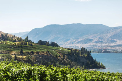
If it wasn't for the ingenuity of irrigation, today's agricultural landscape wouldn't exist in Naramata. In 1907, the Naramata Irrigation Company dug ditches from Naramata Creek and Robinson Creek, and added wooden flumes to distribute water to the o...
How VoiceMap Works


Major Landmarks
-
Naramata Falls
Getting There
Route Overview
-
Total distance1km
-
Final locationUpper Debeck Rd, Naramata, BC V0H 1N1, Canada
-
Distance back to start location857.17m
Directions to Starting Point
Launch your tour from the Creek Park parking lot, just off Naramata Road. The parking lot is approximately a 15 minute drive from Penticton and 2 minutes from Naramata village.
Tips
Places to stop along the way
There are plenty of tranquil spots to stop along the way.
Best time of day
Best hiked in the heat of summer and during the fall of autumn leaves. During freshet, when spring snowmelt swells the creek, stick to the left and take the high trail above the creek.
Precautions
This is an intermediate, wet hike, through a mountain stream and over slippery rocks. Wear sensible footwear that you don't mind getting wet, and use a hiking pole for stability. The trail may not be appropriate for small children or those with reduced mobility. Note portions of the trail cross a stream that swells with water in the spring. Use extra caution when the creek level is high. Other portions of the trail have steep open banks with drop offs. Watch for poison ivy.
Get The App