


Lake Tahoe Driving Tour: From Incline Village to South Lake Tahoe

 About the Tour
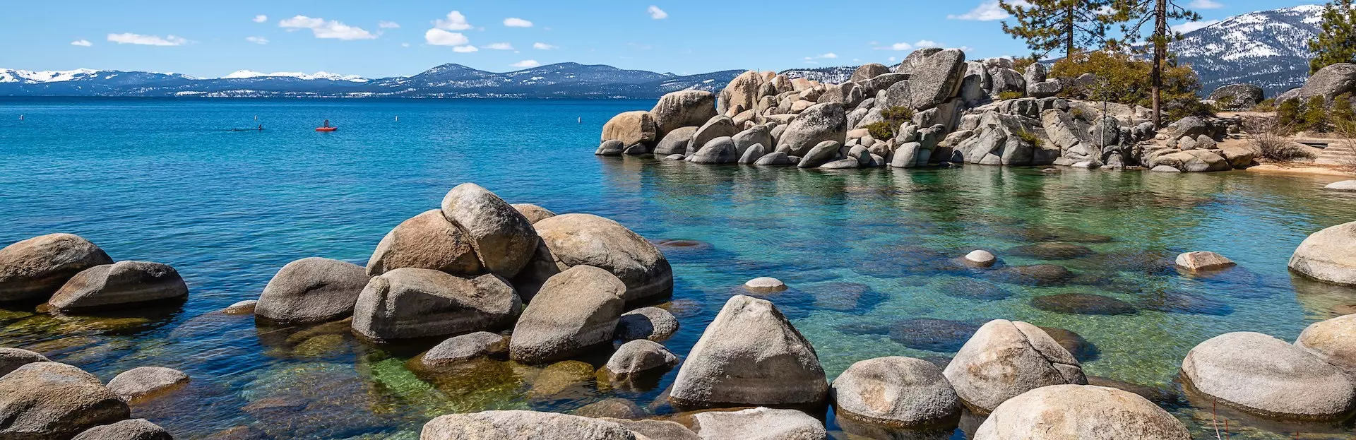
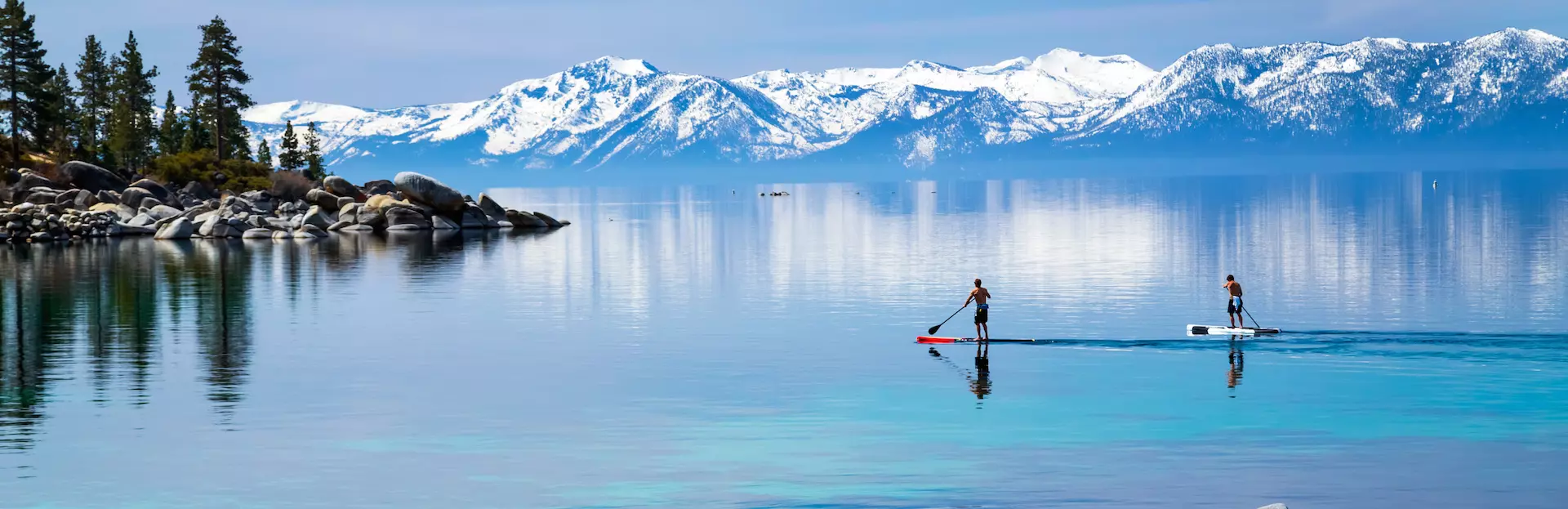
Discover Lake Tahoe’s rugged eastern shore, visit magnificent overlooks and beaches, and learn about the area’s connection to the Pony Express and lumber industry.
This driving tour is one of three that takes you entirely around Lake Tahoe. Our tour begins outside Sierra Sotheby’s International and continues along the eastern shore of Lake Tahoe from Incline Village to South Lake Tahoe. Along the 27-mile journey, you’ll have the option to hike a number of unique trails, visit Sand Harbor Beach, Spooner Lake, or enjoy a meal lakeside.
As you drive and enjoy the spectacular views along this undeveloped eastern shore of Lake Tahoe, you’ll hear stories about the area’s past. You’ll also learn about:
- Incline Villages’ Millionaire’s Row
- The Ponderosa Theme Park
- The history behind Thunderbird Lodge
- The Comstock Lode
- Lake Tahoe’s second growth forest
- Cave Rock and its connection to early Native American History
- Boating on Lake Tahoe
- Early Mail Delivery and the Pony Express
This driving tour can be completed in about 90 minutes without any stops. On the other hand, this is your adventure. You may stop where you want, when you want, and for as long as you want. It’s up to you!
Along the way, you’ll have the option of visiting a few of Lake Tahoe’s out-of-the-way beaches and two Nevada State Parks, hiking to the base of Cave Rock, or enjoying a beverage or meal lakeside. Parking fees are not included in the price of this tour. For more detailed information about the stops on this tour please see “Places to stop along the way” in the tour description.
Please review the “Precautions” section for important information on driving and hiking.
Voice acting credit:
The Pony Express advertisement and background song Ponderosa Ranch
by Brandon Baumann
Download a souvenir brochure of the tour here
A map of all of the hikes may be found here
Tour Producer

Lynn Momboisse

Hi! My name is Lynn. I am a native of California and have resided in Northern California for most of my life. I have a love for discovering the hidden treasures in my own back yard. For many years I lived in beautiful Carmel-by-the-Sea where I co-authored the book Historic Homes and Inns of Carmel-by-the-Sea. During my time in Carmel-by-the Sea, I served on the Carmel Heritage Society, and Historic Resources Board. My love of history and passion for discovering the beauty of the Golden State has led me to create a fun little blog titled "Adventures of a Home Town Tourist" where I recount many of my walking tours and hiking adventures throughout the world. I currently live in the majestic Sierra Foothills and have written several walking and driving tours of the Lake Tahoe area as well as the California Gold Country. I am so excited to continue to share my travel adventures through the power of VoiceMap. I can't wait for you to join me. Happy Adventures!
Save with Lake Tahoe, California audio tour passes
How do passes work?
Preview Location
Location 41
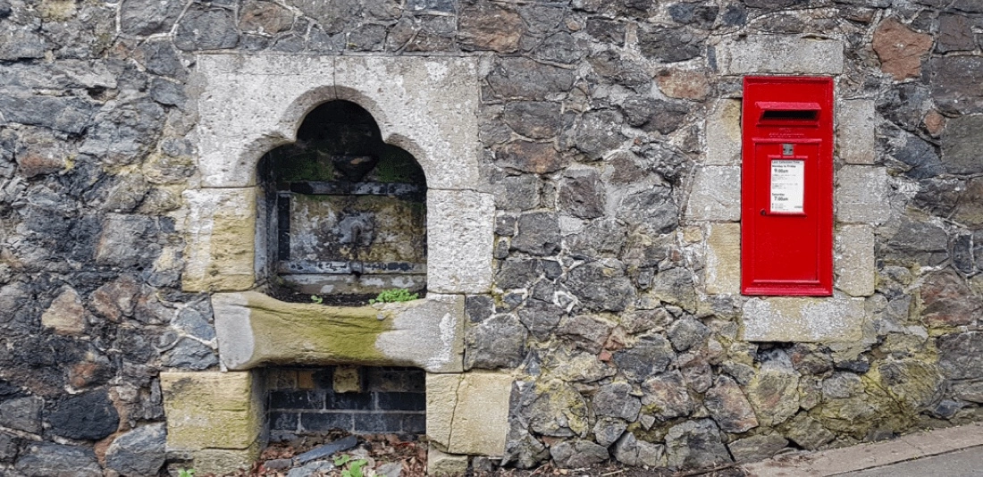
Mail Delivery
Much of these 750 miles were isolated and unsafe. For most that crossed this road did so only once, and they ...
How VoiceMap Works


Major Landmarks
-
Incline Village
-
Flume Trail
-
Sand Harbor

-
Spooner Lake
-
Logan Shoals Vista Point
-
Cave Rock Trail Head
-
Lake Tahoe Cruises / MS Dixie II
-
Zephyr Cove
-
Harrah's Lake Tahoe
-
South Lake Tahoe
Getting There
Route Overview
-
Start location570 Lakeshore Blvd, Incline Village, NV 89451, USA
-
Total distance44km
-
Final locationLincoln Hwy, Stateline, NV 89449, USA
-
Distance back to start location32km
Directions to Starting Point
Parking Lot of the Sierra Sotheby’s International (Realty) 570 Lakeshore Blvd., Incline Village, Nevada. (39.250038, -119.980116). (This is a real estate office with a large parking lot.)
From Reno or Incline Village, Nevada
I-80 East – connect to I-580 S to NV-431 – at the round-about connect to NV-28 W in Incline Village. Take the first left off of NV-28 also known as Tahoe Blvd. in this location, into the parking lot of Sierra Sotheby’s International 570 Lakeshore Blvd.
From South Lake Tahoe and Tahoe City, California
Head southwest on Lake Tahoe Blvd. – turn right onto CA-89N. Once in Tahoe City cross Fanny Bridge and turn right onto N. Lake Blvd. also known in this area as CA-28. Continue across Stateline into Nevada on NV-28. After crossing Lakeshore Blvd. watch for a through driveway on your right. This is Sierra Sotheby’s International 570 Lakeshore Blvd.
Tips
Places to stop along the way
All listed opening and closing times and costs are as of April 2021 and subject to change. All stops are optional. All of the parking fees are not included in this driving tour.
If there is any snow or ice on the ground hikes can be quite hazardous. Only those prepared with the appropriate footwear, clothing and supplies should consider snow hiking.
A map of all of the hikes may be found here
Memorial Point Outlook – 1.9 miles south of Tunnel Creek Café, Incline Village. Limited 20-minute parking on right side of highway is free. There is a public restroom as well as interpretive panels explaining the history of the area. There are two trailheads here that lead to the East Shore Trail. The one at the north end of the parking lot is an ADA accessible, the one at the southern end is accessed by a set of stairs. Walk north or south along this portion of the East Shore Trail and you will have stunning views of Lake Tahoe.
Sand Harbor Nevada State Park – Less than 1 mile south of Memorial Point, Sand Harbor is a Nevada State Park. Open 8am to 1 hour after sunset. There is a parking fee for this park. Keep your receipt and use this for parking at any other Nevada State Park you visit on the same day. This state park features a Visitors Center, restrooms, Kokanee Bar and Grill (spring/summer), horse-drawn sleigh rides, Shakespeare Festival (summer), beach, hiking trails. ½ mile Sand Point Nature Trail Loop begins near the Visitor’s Center and is an easy level trail with interpretive plaques explaining the history of the area.
Skunk Harbor / Newhall Mansion – Trail for Skunk Harbor is 5 ½ miles south of Sand Harbor and 2 ½ miles north of the junction of NV-50. This trailhead has limited free parking along the right side of the highway. Best time for 3-mile roundtrip hike is April through November. The trailhead is behind a steel gate at the southern end of the parking area. There are no bathroom facilities on this hike. At the end of this hike lakeside is what is left of the Newhall Mansion.
Spooner Lake – Located just north of the intersection of Highway 50 and Highway 28, Spooner Lake is part of the Nevada State Park systems. Use a receipt from Sand Harbor if visited on the same day. This park offers a lovely nearly level 1 ½ mile trail around Spooner Lake. There are a few interpretive panels giving the background of the area. During the winter this becomes a cross-country skier’s playground. There are restroom facilities near the trailhead.
Logan Shoals Vista Point – Located about 1 ¼ miles south of Fire Station #5. Watch for the Logan Shoals sign and pull out on the right side of the highway. The ¼ mile paved path off the highway leads to a public restroom and scenic lake overlook.
Cave Rock Trailhead – After exiting the Cave Rock Tunnel take the first left onto Cave Rock Drive. Less than ¼ mile up Cave Road Drive is the trailhead for the Cave Rock Trail. There are only about 3 legal parking spaces for this trailhead. The trail begins to the left of the parking area and is behind a metal gate. Walk this trail about ½ mile to the base of Cave Rock. You may view some people climbing the rock face, but this is very dangerous as the rock is unstable. Do not hike or climb the rock!
Other Hikes in this area:
Lodge Beach Trail – About 1-mile south of Sand Harbor there is a small parking area off the highway on the right side. These are the coordinates 39.175306, -119.923496. The trail is to the right of the metal gate which is to the right of the parking area. There are no bathroom facilities along this trail which ends at a tiny beach overlooking the Thunderbird Mansion Boathouse. You cannot see Thunderbird Mansion from this location. In order to visit Thunderbird Mansion, you must arrange tours ahead of time by visiting this website
Best time of day
Tahoe is beautiful throughout the year. However, if you have an option of when to plan your trip, the best months to visit are April through the end of September when most of the State Parks and roads are open to vehicular traffic.
The busiest time of year in Lake Tahoe is July and August as well as holiday weekends such as Memorial Day, July 4th, and Labor Day.
If you are here during the winter months trailheads will be closed for the season and travel may be limited due to weather conditions. Though it will not effect this driving tour, during heavy snow, Highway 89 may close entirely around Emerald Bay. Plan ahead by checking weather and road conditions at https://roads.dot.ca.gov/ or https://northtahoebusiness.org/weather-and-road-conditions/
Precautions
ROAD CONDITIONS
During winter months, inclement weather, or fires some roads around Lake Tahoe may be closed. To check weather and road conditions please visit https://northtahoebusiness.org/weather-and-road-conditions/ or https://roads.dot.ca.gov/
If traveling during the winter, chains may be required, and some roads may be closed due to weather conditions.
Take your time as you drive around Lake Tahoe and obey the speed limit. If cars are pilling up behind you, use the nearest pullout to allow them to pass.
To prevent possible car break-ins, whenever you park and leave your car, make sure to cover your valuables, lock your car and take your keys.
HIKING TAHOE
The high elevations around Lake Tahoe can make hiking more of a challenge if you are not used to it. The air is thinner here, meaning you will take in less oxygen with each breath, and you may find yourself out of breath after a short distance. If you have any concerns about the length or difficulty of a hike, I hope the descriptions in the “Places to Stop Along the Way” section will be of help.
Do not hike on snow or ice covered trails unless you are prepared with the appropriate clothing, supplies, and footwear. I use the Kahtoola EXOspike traction system which slips over my hiking shoes.
Some of the trails in Tahoe have been affected by fire or weather. Rangers work hard to get trails cleared, but it seems that it is a never-ending battle to have them all up and running at the same time. For that reason, I cannot promise that every hike listed on this driving tour will be open at the time you visit.
Always stay on the trails.
Except during the winter, I highly suggest you carry and use insect repellent. I always wear long pants when I hike; tuck the hem of my pant leg into my socks and spray insect repellent around the tops of my hiking boots. This discourages any ticks or insects from tagging along for the ride.
Avoid touching poison oak. Tecnu is also handy to have if you do happen to unexpectedly touch poison oak. Both Tecnu and a good insect repellent may be purchased over the counter at CVS or Safeway.
WILDLIFE
Don’t feed any wildlife or attempt to touch any critters. Though the most common wildlife sightings you will have on this tour will be deer, chipmunks, or ground squirrels, remember this is bear territory! And black bears are common. If you come across a bear, never approach them! Do not run, make yourself appear to be as large as possible, and back away slowly.
USING VOICEMAP
Search for VoiceMap Audio Tour on the Apple App Store or Google Play Store. Download the free App. Sign Up for a new account with your email and a password of your choice, go to the Explore option/Monterey Peninsula, Santa Cruz, Sacramento, and Lake Tahoe and purchase the tour you are interested in. Download the tour while you have good WiFi coverage. Click on the gear icon on the lower right corner and put the tour into yd/mi mode and turn off Tour Player Autolock and Audio Lost Alert. Then, select the Account option, select the tour you are going to take and read the information in the About option in the upper right. If you need directions to the starting point select Directions. It will open up another window in Apple Maps. You will need to close that window or use your phones interface to go back to the VoiceMap app to start the tour.
Go to your starting point, press start and follow the instructions of the narrator. Place your phone in a hands free holder on your car dashboard as there is a map on your screen that will show our travel route.
We also suggest that you have your phone plugged into an external charging port so that your tour isn’t interrupted by a dead battery.
You may pause this tour at any time using the pause button and resume it at any of the locations along the tour. If you decide stop along the way and take a meal break, or take one of the optional hikes, you should exit your tour by pressing the End Tour downward facing arrow on the top right, then just restart it from the closest location by restarting the tour using the Resume button. It will start at the closest stop.
If you are listening to this tour from home you may just press Continuous Play
and the tour will play for you to listen to.
PHOTO OPPORTUNITIES
This tour is a photographer paradise. Using the Video setting on your phone will shut down the VoiceMap app (and every other open app) and you will need to reload your tour. So, if you are using your phone for photos, try to use the Photo setting.
Get The App