


Lake Tahoe Driving Tour: From Tahoe City to Incline Village

 About the Tour
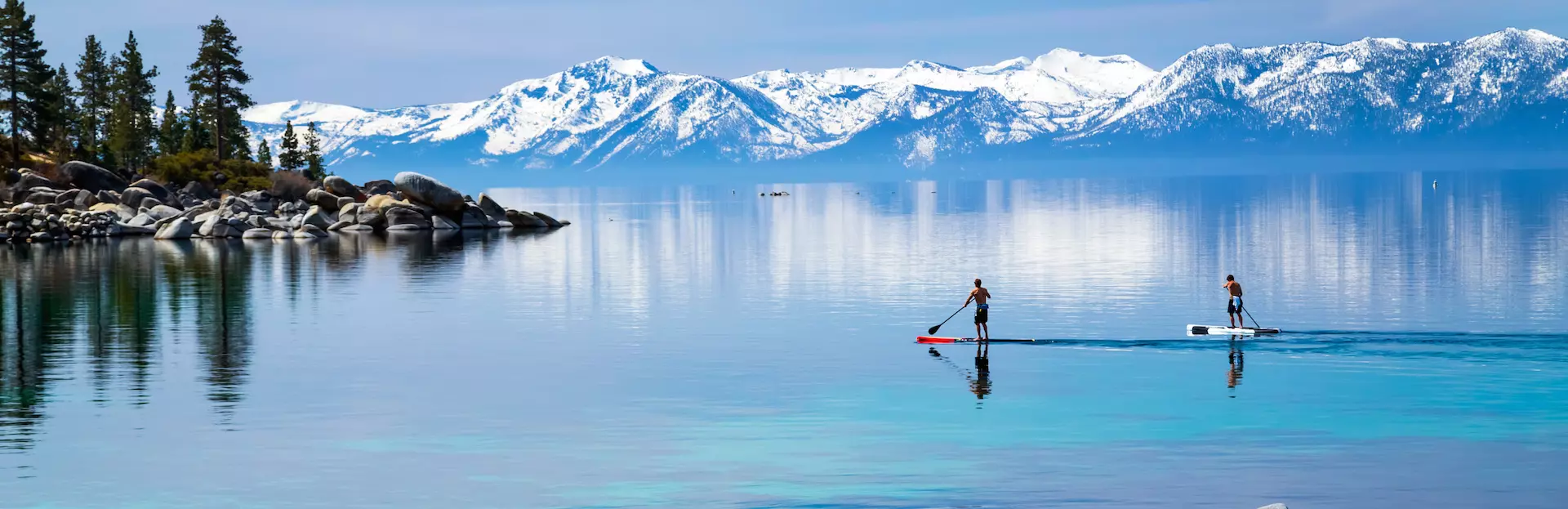
Visit the small towns along Lake Tahoe's northwestern shore and take in unique views from Stateline Fire Lookout and Mount Rose Overlook on this scenic driving tour.
As one of three tours that takes you entirely around Lake Tahoe, this tour begins outside the Gatekeepers Museum and continues north to Carnelian Bay, Tahoe Vista, Kings Beach and Crystal Bay. Our 20-mile drive ends in the northern Lake Tahoe town of Incline Village, at the Mount Rose Scenic Overlook.
As you drive and enjoy the picturesque beauty of this alpine lake, you’ll hear stories about:
- Early Native American history in the Tahoe Basin
- How John Steinbeck and Mark Twain are connected to Lake Tahoe
- Howard Hughes’ property, Summertide
- The lumber industry in Incline Village
- Early modes of transport around Lake Tahoe
- The quaint communities of northwestern Lake Tahoe
This driving tour can be completed in about 90 minutes without any stops. On the other hand, this is your adventure. You may stop where you want, when you want, and for as long as you want. It’s up to you!
Along the way, you’ll have the option of visiting two of Lake Tahoe’s popular beaches, hiking to one of Tahoe’s earliest fire lookouts, or enjoying a beverage or meal lakeside. Parking fees are not included in the price of this tour. For more detailed information about the stops on this tour please see “Places to stop along the way” in the tour description.
Please review the “Precautions” section for important information on driving and hiking.
Voice acting credit:
Samuel Clemens by Brandon Baumann
Download a souvenir brochure of this tour here
A map of all of the hikes can be found here
Tour Producer

Lynn Momboisse

Hi! My name is Lynn. I am a native of California and have resided in Northern California for most of my life. I have a love for discovering the hidden treasures in my own back yard. For many years I lived in beautiful Carmel-by-the-Sea where I co-authored the book Historic Homes and Inns of Carmel-by-the-Sea. During my time in Carmel-by-the Sea, I served on the Carmel Heritage Society, and Historic Resources Board. My love of history and passion for discovering the beauty of the Golden State has led me to create a fun little blog titled "Adventures of a Home Town Tourist" where I recount many of my walking tours and hiking adventures throughout the world. I currently live in the majestic Sierra Foothills and have written several walking and driving tours of the Lake Tahoe area as well as the California Gold Country. I am so excited to continue to share my travel adventures through the power of VoiceMap. I can't wait for you to join me. Happy Adventures!
Save with Lake Tahoe, California audio tour passes
How do passes work?
Preview Location
Location 38
Samuel Clemens
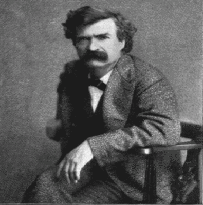
We will be on this about 3 miles. While you drive let me tell you one last story. For this one I need to take you back to 1861.
25 year old Samuel Clemens and his brother Orion had just arrived by...
How VoiceMap Works


Major Landmarks
-
Gatekeeper's Museum

-
Tahoe City
-
Commons Beach
-
Dollar Point
-
Carnelian Bay
-
Gar Woods Grill & Pier
-
Kings Beach
-
Kings Beach State Recreation Area
-
Incline Village
-
Trailhead for Stateline Fire Lookout
Getting There
Route Overview
-
Start location130 W Lake Blvd, Tahoe City, CA 96145, USA
-
Total distance31km
-
Final locationMt Rose Hwy, Incline Village, NV 89451, USA
-
Distance back to start location21km
Directions to Starting Point
Parking Lot of the Gatekeepers Museum, 130 W Lake Blvd., Tahoe City, California.
The entrance to this parking lot is off of W. Lake Blvd. in Tahoe City between Fanny Bridge and Bank of the West.
From Reno or Incline Village, Nevada
I-80 East – connect to I-580 S to NV-431 – connect to NV-28 W in Incline Village. Once in Tahoe City, turn left on W Lake Blvd. cross Fanny Bridge and turn left into the Gatekeepers parking lot.
From Truckee, California
CA-89 South – Once in Tahoe City, turn right on W Lake Blvd. cross Fanny Bridge and turn left into the Gatekeepers parking lot.
From South Lake Tahoe, California
Head southwest on Lake Tahoe Blvd. – turn right onto CA-89N. Once in Tahoe City pass the Wells Fargo Bank and turn right into the parking lot for the Gatekeepers parking lot.
Tips
Places to stop along the way
All listed opening and closing times and costs are as of April 2021 and subject to change. All stops are optional. All of the parking fees are not included in this driving tour.
A map of all of the hikes may be found here
If there is any snow or ice on the ground hikes can be quite hazardous. Only those prepared with the appropriate footwear, clothing and supplies should consider snow hiking.
Tahoe City Gatekeeper’s Museum Area Hike – Parking in Gatekeeper Museum Parking (130 W Lake Blvd., Tahoe City) area free at this time. Open Thursday through Sunday 11am to 5pm, $5 entrance fee. On exhibit Marion Steinbach basket of Native people of North America. From this museum you may also view Lake Tahoe Dam, Fanny Bridge and North Lake Tahoe Visitors Center.
Commons Beach, Tahoe City – Park at Commons Beach parking end of Common’s Beach Road. No fee at this time. Parking lot closed Thursdays, May through October for the Farmer’s Market. During the Farmer’s Market, park in the North Lake Tahoe Visitors Center to visit Common’s Beach.
Kings Beach State Recreation Area – There is a $5 fee to park at this beach where you will find a lovely sand beach, children’s play area, picnic area and public restroom.
Stateline Fire Lookout Trail – The trailhead is about ¼ mile down Lakeview Avenue, Crystal Bay California (39.237082, -120.004048). There is very limited parking on the right side of Lakeview near the trailhead. Do not park in front of the trailhead gate. This fire lookout, which was one of Lake Tahoe’s earliest fire lookouts was built in 1936. The tower was taken down in 2002. Follow the trail to the overlook a little under 1 mile. There is a restroom at the end of the trail and a number of interpretive signs which explain the history of this trail. This is a very scenic hike with views of Crystal Bay and Carnelian Bay.
Other Places to Visit
North Tahoe Regional Park, 6600 Donner Road, Tahoe Vista, California – To reach this park turn left off of CA-28 onto National Avenue. Near the end of National Avenue, turn left onto Donner Road. There is a $5 parking fee for this park. Here you will find a restroom, children’s playground, Treetop Adventures, hiking and biking trails. During the winter there is a Children’s Sled Hill, as well as snowshoeing and cross-country skiing.
Best time of day
Tahoe is beautiful throughout the year. However, if you have an option of when to plan your trip, the best months to visit are April through the end of September when most of the State Parks and roads are open to vehicular traffic.
The busiest time of year in Lake Tahoe is July and August as well as holiday weekends such as Memorial Day, July 4th, and Labor Day.
If you are here during the winter months trailheads will be closed for the season and travel may be limited due to weather conditions. Though it will not effect this driving tour, during heavy snow, Highway 89 may close entirely around Emerald Bay. Plan ahead by checking weather and road conditions at https://roads.dot.ca.gov/ or https://northtahoebusiness.org/weather-and-road-conditions/
Precautions
ROAD CONDITIONS
During winter months, inclement weather, or fires some roads around Lake Tahoe may be closed. To check weather and road conditions please visit here or here
If traveling during the winter, chains may be required, and some roads may be closed due to weather conditions.
Take your time as you drive around Lake Tahoe and obey the speed limit. If cars are pilling up behind you, use the nearest pullout to allow them to pass.
To prevent possible car break-ins, whenever you park and leave your car, make sure to cover your valuables, lock your car and take your keys.
HIKING TAHOE
The high elevations around Lake Tahoe can make hiking more of a challenge if you are not used to it. The air is thinner here, meaning you will take in less oxygen with each breath, and you may find yourself out of breath after a short distance. If you have any concerns about the length or difficulty of a hike, I hope the descriptions in the “Places to Stop Along the Way” section will be of help.
Do not hike on snow or ice covered trails unless you are prepared with the appropriate clothing, supplies, and footwear. I use the Kahtoola EXOspike traction system which slips over my hiking shoes.
Some of the trails in Tahoe have been affected by fire or weather. Rangers work hard to get trails cleared, but it seems that it is a never-ending battle to have them all up and running at the same time. For that reason, I cannot promise that every hike listed on this driving tour will be open at the time you visit.
Always stay on the trails.
Except during the winter, I highly suggest you carry and use insect repellent. I always wear long pants when I hike; tuck the hem of my pant leg into my socks and spray insect repellent around the tops of my hiking boots. This discourages any ticks or insects from tagging along for the ride.
Avoid touching poison oak. Tecnu is also handy to have if you do happen to unexpectedly touch poison oak. Both Tecnu and a good insect repellent may be purchased over the counter at CVS or Safeway.
WILDLIFE
Don’t feed any wildlife or attempt to touch any critters. Though the most common wildlife sightings you will have on this tour will be deer, chipmunks, or ground squirrels, remember this is bear territory! And black bears are common. If you come across a bear, never approach them! Do not run, make yourself appear to be as large as possible, and back away slowly.
We suggest that you have your phone plugged into an external charging port so that your tour isn’t interrupted by a dead battery.
If you are listening to this tour from home you may just press Continuous Play
and the tour will play for you to listen to.
PHOTO OPPORTUNITIES
This tour is a photographer paradise. Using the Video setting on your phone will shut down the VoiceMap app (and every other open app) and you will need to reload your tour. So, if you are using your phone for photos, try to use the Photo setting.
Get The App