Utah's Scenic Highway 12: A Backseat Geology Driving Tour

 About the Tour
Utah's scenic Highway 12 cuts through some of the most geologically dramatic landscapes in North America. On this self-guided driving tour, you'll journey through 250 million years of Earth's history, learning how volcanoes, ancient seas, and powerful faults sculpted the red rock country between Bryce Canyon and Capitol Reef.
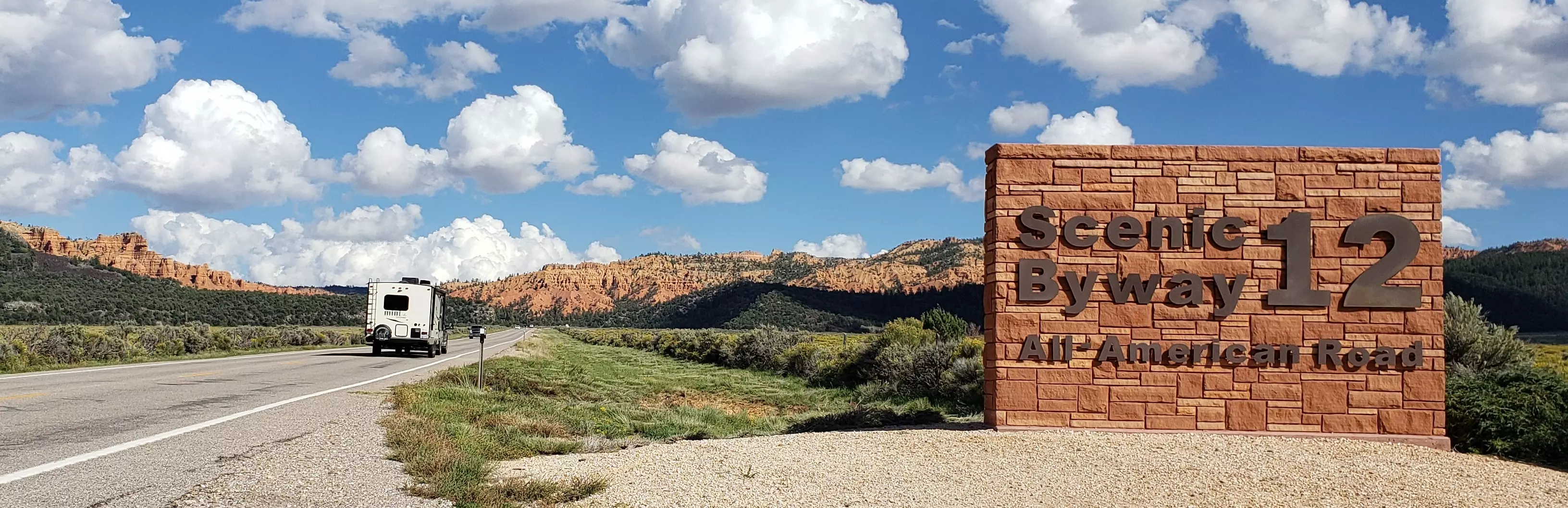
The tour starts at the Red Canyon Café parking lot near the Highway 89 junction. You'll drive through Red Canyon's hoodoo forests, cross the active Sevier Fault - one of the longest fault lines in the world - and traverse the Paunsaugunt Plateau. Along the way, you'll discover how a collapsed supervolcano created the conditions for Bryce Canyon's distinctive spires, why certain rock layers are bleached white while others glow red, and what the triangular fractures in hoodoos reveal about underground stress and strength.
As you continue east, you'll drop through the colorful Grand Staircase, descending from the age of mammals into the age of dinosaurs. You'll learn to identify ancient sand dunes, seafloor deposits, and river systems just by looking at the rock. The route crosses the dramatic Escalante Monocline, winds along the narrow Hogsback ridge, and climbs Boulder Mountain - where glacial lakes and volcanic flows tell their own stories. The tour ends at the junction with Highway 24 in Torrey, on the edge of Capitol Reef National Park, where the oldest dinosaur - bearing rocks in the region await exploration.
On this detailed 200-minute geology tour, you'll have a chance to:
- Stand on the active Sevier Fault itself and see how nearby volcanic rocks capture its steady, ongoing motion
- Learn why the Claron Formation creates thousands of hoodoos while most limestones don't form any
- Discover fossils from the Western Interior Seaway, a warm ocean that once flooded North America from Las Vegas to Chicago
- Explore where hadrosaurs, ceratopsians, and even Tyrannosaurus rex roamed the Cretaceous shoreline
- See the Navajo Sandstone's sculpted slickrock, formed by wind-blown sand dunes 200 million years ago
- Witness how Boulder Mountain transformed from the lowest valley to the highest peak through volcanic protection
This tour transforms a scenic drive into a journey through deep time, revealing the forces that built and continue to shape the Colorado Plateau. While you never need to get out of your vehicle, there are also plenty of optional stops for you to get closer to the scenery while stretching your legs.
Tour Producer

Backseat Geology

Do you want to learn to see the Earth the way an art critic sees a painting?
To turn the blur of the highway into a gallery of ancient worlds — dinosaurs included!
Backseat Geology is for travelers who want more than a souvenir photo. Most people already know more geology than they realize, they just haven’t been shown where to look. These tours are built to give you orientation as much as information: the backseat guidance that points out the right cliff, the right layer, the right clue, and then connects it to something you already understand.
On these tours, the road becomes your canvas and the rocks become the brushstrokes. We show you the patterns, the symmetries, and the underlying logic of the land. As your confidence grows, so does the meaning of every ridge and valley in your rearview mirror.
By the time you reach your destination, you won’t just be admiring a pretty view, you’ll be reading a masterpiece.
Save with Passes
Preview Location
Location 21
Tropic Shale
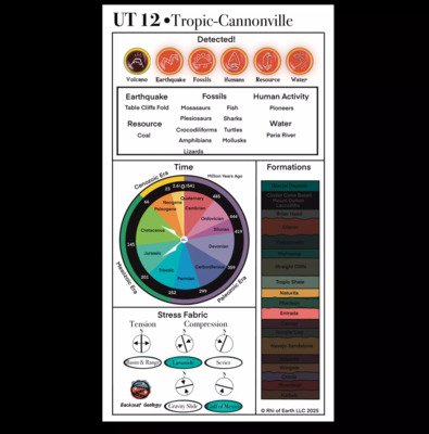
Tropic can be considered a microcosm. The town's settlers gave it that name because it's warmer here than everywhere else around. Travel back 90 million years to the age of the rocks around it, and coincidentally you'd find ... Read More
How VoiceMap Works


Major Landmarks
-
Red Canyon
-
Bryce Canyon National Park
-
Grand Staircase-Escalante National Monument
-
Kodachrome Basin State Park
-
Dixie National Forest
-
Escalante Petrified Forest State Park
-
Anasazi State Park Museum
-
Torrey
Getting There
Route Overview
-
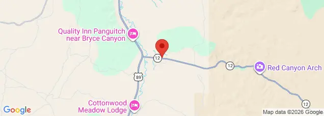
Start location3228-3270 UT-12, Panguitch, UT 84759, USA
-
Total distance200km
-
Final location44 UT-12, Torrey, UT 84775, USA
-
Distance back to start location104km
Directions to Starting Point
The tour begins at the Red Canyon Village Cafe and gas station shortly after the turn off from highway 89 onto highway 12. It is several yards or meters up the road on the left hand side.
Tips
Places to stop along the way
Viewing areas, hikes, and visitor centers are mentioned in the tour.
Best time of day
The tour is best done during the day, when there is no snow. Ideal months are from April to October. If you plan to do any of the optional hikes beware of monsoons and hot weather in July and August.
Precautions
The highway ranges in elevation from 6,000 to nearly 10,000ft. Altitude sickness is possible and from November to March large snow storms may lead to road closures.
The tour may be completed entirely within the car. However for general safety and best experience sunglasses, sunblock, and water with electrolytes are recommended. In the winter a spare blanket and gloves are advisable.
Get The App