


A Chicago River Walking Tour: 200 Years of History

 About the Tour
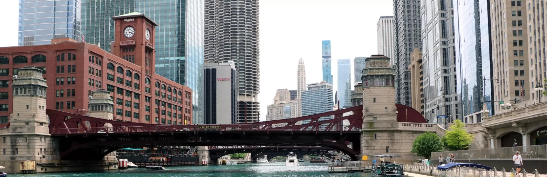
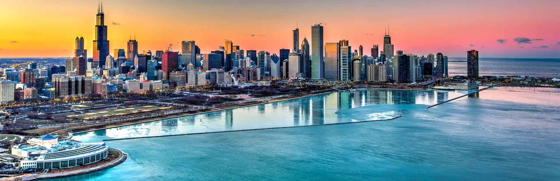
The Chicago River has been the heart and soul of the city for hundreds of years. It was here, at the mouth of this river that Chicago’s first settler built a farm. In the 1800s, the river became home to the world’s fourth largest harbor, and today it’s central to the city’s tourism industry. Which other city dyes its river green to celebrate St. Patrick’s Day?
This walking tour will take you on a loop to follow part of the riverwalk, starting and ending near the McCormick Bridgehouse & Chicago River Museum. Along the way, I’ll share the history of the area and tell you about the city’s immigrant communities, its railway infrastructure, and its infamous freight tunnel system that remains hidden underground today. I’ll also tell you how a flood convinced engineers that tunnels, not bridges, were the future of getting across the Chicago River.
On this tour, you’ll have the opportunity to:
- Hear about the river’s earliest days, from the Native People to the early settlers who built their homes along the riverbank
- Find out about the brothels, crooks and everyday workers that populated the harbor in the 1800s
- See many of Chicago’s best-known buildings, including the Wrigley Building, Marina City, and the Reid Murdoch Building
- Discover how the river has gone from clean, to polluted, and back to fairly clean over the past 200 years
- Listen to the stories of the city’s two most tragic boat disasters, including the sinking of the S. S. Eastland in 1915
- Take in one of the largest Vietnam Veteran memorials in the nation, near where this tour ends
This walk around the river’s main channel allows you to see the same sights as you would on a boat trip for a fraction of the cost. Along the way, there are excellent outdoor restaurants and bars, and nice indoor eateries along Kinzie Avenue, also on our route.
I’ll show you a side of the city and the river that’ll even surprise locals. So join me on this two-mile tour (with only a few sets of stairs) and see Chicago how it should be seen, at river level!
Tour Producer

Richard Junger

Retired professor, urban historian, freelance journalist and former broadcaster. Check out my "Real, True Backstories of Old Chicago: As told Day by Day from 1673 to 1925". I recount hundreds of the same kinds of stories as heard in my Chicago VoiceMap tours, some shorter and some longer.
Available as an Amazon Kindle ebook. Just search for "Backstories of Old Chicago", Otherwise watch for me on the streets of Chicago. I'm the guy who's always asking "guess what happened here?" as I walk, bicycle, or drive with friends.
The United States has such a dynamic heritage, and historic places and bits of our culture are threatened with extinction every day. My VoiceMap philosophy is to try to rescue what has been lost and retell it to preserve its story. Sadly, too many of my tours are theater of the mind because the places and artifacts we all want to know more about are gone.
But imagination is continuity, and re-envisioning the past allows us to see things as they once were. Rekindle the spirit of your childhood and come along with me as we make real long lost worlds in our minds!
Save with Chicago, Illinois audio tour passes
How do passes work?
Preview Location
Location 22
Chicago drawbridges
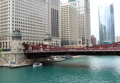
Chicago has 43 operational drawbridges, second only to the city of Amsterdam, although a good number of them are railroad and not traffic bridges like the Frank...
How VoiceMap Works


Major Landmarks
-
Chicago River
-
River Esplanade Park
-
Pioneer Court
-
Wrigley Building
-
Kinzie Street
-
Merchandise Mart
-
Riverwalk
-
S. S. Eastland Memorial
-
Vietnam Veterans' Memorial Plaza
Getting There
Route Overview
-
Start location99 Chicago Riverwalk, Chicago, IL 60601, USA
-
Total distance3km
-
Final location401 N Michigan Ave, Chicago, IL 60611, USA
-
Distance back to start location53.49m
Directions to Starting Point
On foot, the tour starts at N. Michigan Ave and East Upper Wacker Drive to the left of the DuSable Bridge keepers house
CTA "L" lines -- get off at State/Lake station and walk north and east to Michigan and Wacker
CTA bus -- #19 bus runs around the Loop and stops near Michigan and Wacker and the #6 bus travels north/south on Michigan from the museums
Millennium Station -- the CTA Metra Electric lines and the Indiana South Shore Railway stop there. Just go up to street level and walk north four blocks on Michigan
Metra Ogilvie and Union stations are longer walks. Consider the "L" or a CTA bus
Parking garages -- available but pricey. It may save to use mass transit. One of the cheaper garages is under Millennium Park at 5 S. Columbus Drive. Walk north on Michigan Avenue to the bridge.
Tips
Places to stop along the way
This tour is best enjoyed in its entirety. Feel free to pause and resume the tour to rest or eat but at river level there is only the river. Public restrooms are available in the Merchandise Mart in the middle of the tour or near the end of the Riverwalk.
Best time of day
At river level, tours are good at any daylight hour when the weather is decent. Surface automotive traffic is worse mornings 7 to 9:30 and afternoons 4 to 6:30 local time. Traffic is less of a problem on weekends, but the streets can still be busy. Chicago is the windy city
and a chilly Lake Michigan wind can whip through the river canyon in the late fall, winter, and early spring. Check the weather forecast those times of the year and dress appropriately. Icy times may not be the best for this tour given the proximity to the river. Always walk carefully.
Precautions
Chicago's big buildings can do things to GPS signals. If the audio stops for an extended period of time, use your smartphone map to get back/stay on the route.
As mentioned in the tour, watch out for right turns on red lights and motorists speeding through red lights. Tour is best during good visibility daylight hours, but downtown Chicago is a safe city.
Get The App